More about this route
Gallery


ROUTE & DIRECTIONS (BLUE)
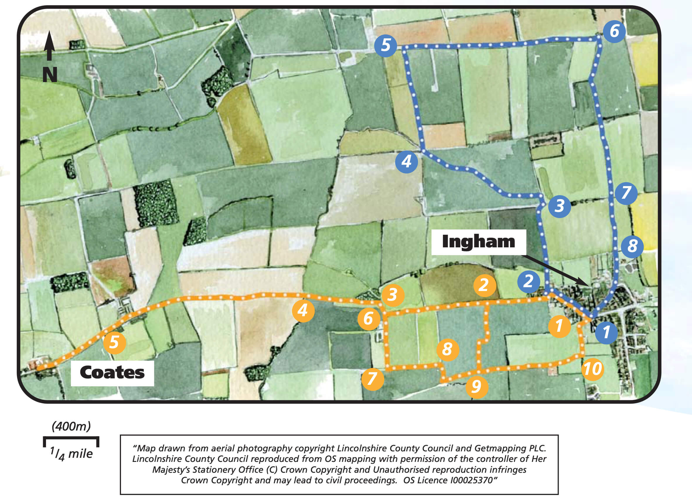
- 1Leave the car park and walk towards the village green. Keep to the left, with the village shop ahead of you. Turn left and walk along West End. Look out for the remains of a windmill now part of a house.
- 2As West End bends to the left take the public bridleway on the right, Short Lane. Admire the views to your left across the Trent Valley dominated by the cooling towers of the power stations.
- 3At a junction of tracks, continue straight on for approximately 30m before turning left onto a bridleway which follows the dyke as it weaves its way across the field.
- 4At the end of the field turn right and cross two bridges. Follow the bridleway keeping the dyke and then the remnants of a hedge on your right.
- 5At the road turn right and follow it for approximately one mile until it bends sharply to the left.
- 6Turn right along the track, a public footpath. When the track bends sharply to the left, continue straight on across the bridge. Walk straight across the middle of the field aiming for the orange/red-roofed house, visible in the distance.
- 7At the end of the field, at a junction of footpaths, keep straight on and cross the track and bridge and head to the right of the orange/red-roofed house.
- 8Follow the footpath between the houses onto a lane and walk straight ahead. Before the lane ends look out for a footpath on the right which goes between some houses and the hedge. Cross Grange Close and follow the footpath straight ahead between the house and hedge. At the road turn right to continue in the same direction. Cross the green to return to the Village Hall.
Accessibility & suitability