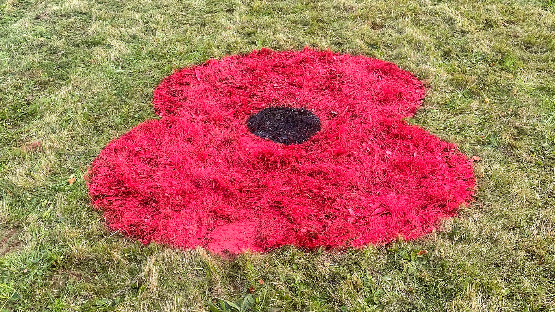
Giant poppies will be painted on ten roundabouts across the county to mark Remembrance Day.
The painted iconic red and black flowers will appear over the coming days on roundabouts near Lincoln, Grantham, Spalding, Boston, Bourne, Louth, Gainsborough and Gunby as the county shows its respect to the Armed Forces. These will remain in place throughout November.
The giant poppies will be located on each approach to the following roundabouts:
- Gunby Roundabout
- A16/A157 Roundabout
- A631/A156 Roundabout
- Riseholme Roundabout
- A15 Sleaford Road (part of Lincoln Eastern Bypass)
- B1174 Tollemache Road (part of Grantham Southern Relief Road)
- A52/B1176 Roundabout
- Bourne Road / Raymond Mays Way
- A16/A151 Roundabout
- A17/A16 Roundabout
Councillor Richard Davies, executive member for highways, said: “After the incredibly positive feedback we received last year from locals and visitors alike, we’ve decided to show our support by painting poppies on some of our major junctions again this year.
“There will also be over thirty celebrations taking place around the county on Remembrance Sunday, the fourteenth of November.
“As such, those travelling on the day may experience some minor delays as communities throughout Lincolnshire gather to remember and honour all of our armed forces members who have died in the line of duty.”
Street Closures
All of the street closures outlined below will be in place on Sunday 14 November (except for Welton, which will take place on Thursday 11 November).
Restrictions will be implemented as and when required in each location. Signage detailing accurate dates and times will be displayed on-site in advance.
Bardney
- B1190 (Between B1202 & Manor Close)
- Silver Street (Between B1190 & a point 25 metres East)
- Church Lane (25m from junction Horncastle Road)
- Horncastle Road (25m from junction Silver Street)
Billinghay
- Queen Street
- Bridge Street
- Victoria Street
- Church Street
Boston
- Wide Bargate
- Bank Street
- Market Place (Bank Street to Wormgate)
Bourne
- North Street/South Street (Between St Gilberts Road & a point 600 metres South)
- Bracebridge Heath
- A607 Grantham Road (From Church to A15)
- A15 (From Canwick Avenue to Davys Lane)
Caistor
- Butter Market
- South Street (From Chinese takeaway to Mill Lane)
Colsterworth
- High Street
- Back Lane
Coningsby
- A153 (Between Wharfe Lane & Thorpe Road)
Deeping St James
- Church Street (Hereward Way to Church Gate)
Freiston
- Church View
- Church Road
Gainsborough
- Fawcett Street
- Gladstone Street
- Parnell Street
Grantham
- St Peters Hill
- St Peters Hill Slip Road
- High Street
- Vine Street
- Swinegate
Heckington
- High Street
- Church Street
Holbeach
- High Street (Between B1168 & a point 5m West of Albert Street)
Horncastle
- West Street
- Manor House Street
- Bridge Street
- High Street
- North Street
- A153 Bull Ring/North Street/Louth Road (A158 to Stanhope Road)
Kirton
- High Street
- Station Road
Lincoln Castle
- Drury Lane (Junction of Exchequergate)
- Minster Yard
- Exchequergate
Long Sutton
- West Street (From Taverners Mews to junction of Market Place)
- Market Place (From Junction of West Street to Bank)
Louth
- Upgate
- Mercer Row
- Market Place
- Eastgate
- Northgate
- Ramsgate
Market Deeping
- Church Street (From Market Place to St Guthlac Ave)
Market Rasen
- Market Place
- George Street
- Queen Street
- Union Street
- Chapel Street
- Linwood Road
- Church Street
- King Street
- Mill Street
- Oxford Street
- Waterloo Street
Metheringham
- High Street (Fen Road to Middle Street)
- Princes Street (High Street to Hall Yard)
Nettleham
- Vicarage Lane
- Church Street
- The Green
North Somercotes
- A1031 (In vicinity of War Memorial)
Pinchbeck
- Knight Street (B1180 to Church Street)
- Church Street (Knight Street to Rose Lane)
- Rose Lane (Church Street to 10 metres West of Brayfields)
- Church Walk (Church Street to Knight Street)
Ruskington
- Church Street
- Chapel Street (Church St to the Church)
- Rectory Road (Junction of Church Street)
- Sleaford Road (From junction Church Street to Elmtree Road)
- Station Road (From Silver Street to Church Road)
Skegness
- Beresford Avenue (Lumley Road to St Matthews Church)
- Lumley Road (Lumley Ave to Rutland Road)
- Lumley Avenue (Scarborough Rd to Lumley Rd)
Sleaford
- Station Road
- B1517 Northgate
- Eastgate
Spalding
- Market Place
- Bridge Street
- Broad Street
- London Road
- Church Street
- Church Gate
- High Street
Spilsby
- Market Street
- Market Place
- High Bridge
- Church Street
- Church Gate
Stamford
- Broad Street
- Star Lane
Woodhall Spa
- Station Road
- Stixwould Road
Welton (11/11/2021)
- Lincoln Road
- Manor Lane (Between Sudbeck Lane and Cliff Road)